Log in
All resources
Create a design
3,115 Free Artworks of French Language
bibliothèque nationale de france
atlas, ou représentation du monde universel et des parties d'icelui, faicte en tables et descriptions très amples et exactes, divisé en deux tomes. édition nouvelle... - btv1b53103889w
louis cordier
a map of the british empire in america with the french and spanish settlements adjacent thereto
french-language maps
lucas janszoon waghenaer
edmé jean pigal
die zee caerte van portugal; tusschen camino en montego, alsoe dat landt all daer in sijn ghedaente is, met alle sijne haeven enn ondiepten, met groeter naersticheijt en vliedt ghecorrigeert - btv1b531945351
die caerte vande zeekusten van biscaien, zeer quade havens voer groote schepen tusschen rio de sella en aviles - lucas io(ann)es aurigarius inve(n)t(or) ; ioannes a doetecum fecit - btv1b531944702
caerte vande zee custen van gallissien, van ortugal tot voer bij c. de finisterre, in zyn wesen ende gedaente comende zeijlen uuth de spaensche zee - lucas io(ann)es aurigarius inventor ; ioannes à... - btv1b53194473d
1810 maps of north america
1810 maps of mexico
charles motte
edmé jean pigal
adèle-anaïs toudouze
l'assiette au beurre
abel faivre
19th-century maps of the malay archipelago
19th-century maps of southeast asia
old maps of the kingdom of naples
1700s maps of italy
atlas, ou représentation du monde universel et des parties d'icelui, faicte en tables et descriptions très amples et exactes, divisé en deux tomes. édition nouvelle... - btv1b53103889w
maps facing west
jean-fréderic phélypeaux
guillaume dheulland
atlas, ou représentation du monde universel et des parties d'icelui, faicte en tables et descriptions très amples et exactes, divisé en deux tomes. édition nouvelle... - btv1b53103889w
17th-century maps of guyana
map of the circle of westfalia by sanson
louis cordier
die zee caerte van portugal; tusschen camino en montego, alsoe dat landt all daer in sijn ghedaente is, met alle sijne haeven enn ondiepten, met groeter naersticheijt en vliedt ghecorrigeert - btv1b531945351
bibliothèque nationale de france
french-language literature
abel patoux
die caerte vande zeekusten van biscaien, zeer quade havens voer groote schepen tusschen rio de sella en aviles - lucas io(ann)es aurigarius inve(n)t(or) ; ioannes a doetecum fecit - btv1b531944702
bibliothèque nationale de france
caerte vande zee custen van gallissien, van ortugal tot voer bij c. de finisterre, in zyn wesen ende gedaente comende zeijlen uuth de spaensche zee - lucas io(ann)es aurigarius inventor ; ioannes à... - btv1b53194473d
bibliothèque nationale de france
chartae orarum marinarum partim normandiae, partum britanniae, et insularum circa eas sitarum - lucas io(ann)es aurigarius inventor ; ioannes a doetecu. fecit - btv1b531567357
bibliothèque nationale de france
canalis celebris vel navigationis à bristovio, atque totius situs inter galliam belgicam et britanniam accurata delineatio, eiusdemque terrae verus vultus cum suis miliaribus, ventis ac ascendentibus -... - btv1b53225454g
bibliothèque nationale de france
beschrijvinghe der zee custen van engelandt tusschen wicht ende doveren, met die principale havenen ende gedaenten des selven landts - per lucas ioannem aurigarius enchusia ; ioes à doetecu. f. - btv1b53225457t
bibliothèque nationale de france
die custe van lijfflandt, met de eijlanden daer beneffens, also hem dat landt aldaer verthoont ende in zijn ghedaente is, van ekeholmen off tot sijburchs ness tho - lucas ioannis aurigarius inventor... - btv1b532358064
bibliothèque nationale de france
chartae orarum marinarum partim normandiae, partum britanniae, et insularum circa eas sitarum - lucas io(ann)es aurigarius inventor ; ioannes a doetecu. fecit - btv1b531567357
bibliothèque nationale de france
de custen van een deel van denemarken ende swedenrijck, beginnende van vuijtste tot calmer toe - lucas ianß wag. inve(n)t(or) ; (ioannes à doetecum fecit) - btv1b53235859j
bibliothèque nationale de france
17th-century maps of vienna
maps by nicolaes visscher i
de caerte ofte zee custen van pruijssen, met zijne haffen ofte groote rivieren, vander memel off tot heel tho, alsoe tlant aldaer in zijn wesen is - luca ioannis aurigarius aut. ; ioannes à doetecum fecit - btv1b53235794k
bibliothèque nationale de france
chartae orarum marinarum partim normandiae, partum britanniae, et insularum circa eas sitarum - lucas io(ann)es aurigarius inventor ; ioannes a doetecu. fecit - btv1b531567357
bibliothèque nationale de france
die caerte vande zeekusten van biscaien, zeer quade havens voer groote schepen tusschen rio de sella en aviles - lucas io(ann)es aurigarius inve(n)t(or) ; ioannes a doetecum fecit - btv1b531944702
bibliothèque nationale de france
die custe van lijfflandt, met de eijlanden daer beneffens, also hem dat landt aldaer verthoont ende in zijn ghedaente is, van ekeholmen off tot sijburchs ness tho - lucas ioannis aurigarius inventor... - btv1b532358064
bibliothèque nationale de france
context files from gallica
lucas janszoon waghenaer
bibliothèque nationale de france
hendrik de leth
die zee custen van biscaijen tusschen laredo ende sentillana soe hem dat selve landt all daer verthoont ennde opdoet - lucas ioannes aurigarius inventor ; ioannes à doetecum fecit - btv1b531945334
bibliothèque nationale de france
orae maritimae norvegiae inter bergas et ieddrum, quemadmodum ibi in sua stat figura, quum lidam versus est inde velisicatur, accurata descriptio - lucas ioannes aurigarius inventor ; ioannes à doetecum fecit - btv1b53235848p
bibliothèque nationale de france
beschrijvinghe der zee custen van engelandt tusschen wicht ende doveren, met die principale havenen ende gedaenten des selven landts - per lucas ioannem aurigarius enchusia ; ioes à doetecu. f. - btv1b53225457t
bibliothèque nationale de france
de caerte ofte zee custen van pruijssen, met zijne haffen ofte groote rivieren, vander memel off tot heel tho, alsoe tlant aldaer in zijn wesen is - luca ioannis aurigarius aut. ; ioannes à doetecum fecit - btv1b53235794k
bibliothèque nationale de france
orae maritimae norvegiae inter bergas et ieddrum, quemadmodum ibi in sua stat figura, quum lidam versus est inde velisicatur, accurata descriptio - lucas ioannes aurigarius inventor ; ioannes à doetecum fecit - btv1b53235848p
bibliothèque nationale de france
canalis celebris vel navigationis à bristovio, atque totius situs inter galliam belgicam et britanniam accurata delineatio, eiusdemque terrae verus vultus cum suis miliaribus, ventis ac ascendentibus -... - btv1b53225454g
bibliothèque nationale de france
context files from gallica
lucas janszoon waghenaer
die zee custen van biscaijen tusschen laredo ende sentillana soe hem dat selve landt all daer verthoont ennde opdoet - lucas ioannes aurigarius inventor ; ioannes à doetecum fecit - btv1b531945334
bibliothèque nationale de france
caerte vande zee custen van gallissien, van ortugal tot voer bij c. de finisterre, in zyn wesen ende gedaente comende zeijlen uuth de spaensche zee - lucas io(ann)es aurigarius inventor ; ioannes à... - btv1b53194473d
bibliothèque nationale de france
beschrijvinghe der zee custen van engelandt tusschen wicht ende doveren, met die principale havenen ende gedaenten des selven landts - per lucas ioannem aurigarius enchusia ; ioes à doetecu. f. - btv1b53225457t
bibliothèque nationale de france
de caerte ofte zee custen van pruijssen, met zijne haffen ofte groote rivieren, vander memel off tot heel tho, alsoe tlant aldaer in zijn wesen is - luca ioannis aurigarius aut. ; ioannes à doetecum fecit - btv1b53235794k
bibliothèque nationale de france
canalis celebris vel navigationis à bristovio, atque totius situs inter galliam belgicam et britanniam accurata delineatio, eiusdemque terrae verus vultus cum suis miliaribus, ventis ac ascendentibus -... - btv1b53225454g
bibliothèque nationale de france
die caerte vande zeekusten van biscaien, zeer quade havens voer groote schepen tusschen rio de sella en aviles - lucas io(ann)es aurigarius inve(n)t(or) ; ioannes a doetecum fecit - btv1b531944702
bibliothèque nationale de france
die zee caerte van portugal; tusschen camino en montego, alsoe dat landt all daer in sijn ghedaente is, met alle sijne haeven enn ondiepten, met groeter naersticheijt en vliedt ghecorrigeert - btv1b531945351
bibliothèque nationale de france
die custe van lijfflandt, met de eijlanden daer beneffens, also hem dat landt aldaer verthoont ende in zijn ghedaente is, van ekeholmen off tot sijburchs ness tho - lucas ioannis aurigarius inventor... - btv1b532358064
bibliothèque nationale de france
caerte vande zee custen van gallissien, van ortugal tot voer bij c. de finisterre, in zyn wesen ende gedaente comende zeijlen uuth de spaensche zee - lucas io(ann)es aurigarius inventor ; ioannes à... - btv1b53194473d
bibliothèque nationale de france
orae maritimae norvegiae inter bergas et ieddrum, quemadmodum ibi in sua stat figura, quum lidam versus est inde velisicatur, accurata descriptio - lucas ioannes aurigarius inventor ; ioannes à doetecum fecit - btv1b53235848p
bibliothèque nationale de france
de custen van een deel van denemarken ende swedenrijck, beginnende van vuijtste tot calmer toe - lucas ianß wag. inve(n)t(or) ; (ioannes à doetecum fecit) - btv1b53235859j
bibliothèque nationale de france
die zee custen van biscaijen tusschen laredo ende sentillana soe hem dat selve landt all daer verthoont ennde opdoet - lucas ioannes aurigarius inventor ; ioannes à doetecum fecit - btv1b531945334
1580s maps of spain
die zee caerte van portugal; tusschen camino en montego, alsoe dat landt all daer in sijn ghedaente is, met alle sijne haeven enn ondiepten, met groeter naersticheijt en vliedt ghecorrigeert - btv1b531945351
bibliothèque nationale de france
de custen van een deel van denemarken ende swedenrijck, beginnende van vuijtste tot calmer toe - lucas ianß wag. inve(n)t(or) ; (ioannes à doetecum fecit) - btv1b53235859j
bibliothèque nationale de france
galliarum descriptio ex sansonum tabulis editis et manuscriptis excerpta ope animadversionum domni martini bouquet benedictini, et dissertationum domini leboeuf autissiodor. canonici, emendata ab aegidio... - btv1b53227110k
guillaume sanson
prints by james gillray in the british museum
satirical prints in the british museum
le royaume de france distingué by guillaume sanson
maps by nicolas sanson
17th-century maps of africa
maps from gallica
map of the upper rhenian circle by sanson
1700s maps of north rhine-westphalia
statue equestre de louis le bien aimé erigée le 14 février 1763 - le charpentier sculpsit ; de seve delinaevit - btv1b53181657s
baroque
romanticism,neoclassicism
1852 maps of france
edmé jean pigal
3 people in art
maps of county armagh
1760s maps of ireland
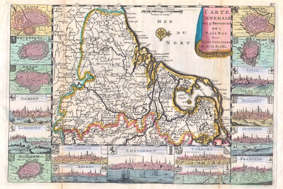
1710s maps of the netherlands
18th-century maps of belgium
henri le roy (1579-)
diocese of aire
lucas janszoon waghenaer
1580s maps of spain
lucas janszoon waghenaer
maps facing east
alexis-hubert jaillot
henri sengre
considérations géographiques et physiques sur les nouvelles découvertes au nord de la grande mer
1755 maps of north america
18th-century maps of the black sea
maps by louis brion de la tour
old maps of vermandois
old maps of santerre
maps by louis brion de la tour
french-language maps
18th-century maps of north america
1708 maps of north america
toilets in art
jules bourdet
edmé jean pigal
carte du royaume de bohême, dicisé en xv cercles, avec le comté de glatz et le territoire d'egra. réduite d'après la carte de muller, et revue d'après celles de maurice vogt, d'hofman et de j. de ram... - btv1b532026015
johannes de ram
carte du royaume de bohême, dicisé en xv cercles, avec le comté de glatz et le territoire d'egra. réduite d'après la carte de muller, et revue d'après celles de maurice vogt, d'hofman et de j. de ram... - btv1b532026015
johannes de ram
17th-century portrait paintings of women, artist, location and year missing
françois jouvenet
maps by jacques-nicolas bellin
1752 maps
amérique méridionale (1748, d'anville)
rococo
17th-century maps of cambridgeshire
old county maps of cambridgeshire
old maps of regions of france
daniel de la feuille
a map of the british empire in america with the french and spanish settlements adjacent thereto
bibliothèque nationale de france
a map of the british empire in america with the french and spanish settlements adjacent thereto
bibliothèque nationale de france
a map of the british empire in america with the french and spanish settlements adjacent thereto
bibliothèque nationale de france
a map of the british empire in america with the french and spanish settlements adjacent thereto
bibliothèque nationale de france
a map of the british empire in america with the french and spanish settlements adjacent thereto
bibliothèque nationale de france
bibliothèque nationale de france
raymond bonheur
gouvernement général de picardie qui comprend la généralité d'amiens divisée en ses huit elections. avec l'artois, et les frontières des pays-bas. dressé sur les mémoires les plus nouveaux - par le... - btv1b59717521
bibliothèque nationale de france
bibliothèque nationale de france
félix robaut
de zee kuste rontomme oesel ende een deel van curlandt beginnende van dagher oort tot derwinde, also hem tlandt daer verthoont, ende in zijn ghedaente is - luca ioannis aurigarius autore ; ioannis à... - btv1b532358081
bibliothèque nationale de france
gouvernement général de picardie qui comprend la généralité d'amiens divisée en ses huit elections. avec l'artois, et les frontières des pays-bas. dressé sur les mémoires les plus nouveaux - par le... - btv1b59717521
bibliothèque nationale de france
beschrijvinge van een deel vann schottlandt van bambourg tot aberdein daer edenburg de princepaele coepstat in is, so hem tlant daer verthoont beneffens 2 eijlende - lucas iansz wagenaer ; ioannes à... - btv1b53225427k
bibliothèque nationale de france
atlas, ou représentation du monde universel et des parties d'icelui, faicte en tables et descriptions très amples et exactes, divisé en deux tomes. édition nouvelle... - btv1b53103889w
maps of the peloponnese by gerardus mercator
carte des alpes by guillaume sanson (1690)
bibliothèque nationale de france
atlas, ou représentation du monde universel et des parties d'icelui, faicte en tables et descriptions très amples et exactes, divisé en deux tomes. édition nouvelle... - btv1b53103889w
17th-century maps of silesia
atlas, ou représentation du monde universel et des parties d'icelui, faicte en tables et descriptions très amples et exactes, divisé en deux tomes. édition nouvelle... - btv1b53103889w
maps of guinea by mercator-hondius
evesché de luçon, dédié à... messire henry de barrillon évesque et baron de luçon... - par son très humble et très obéissant serviteur g. sanson... ; gravé par liébaux - btv1b532271435
guillaume sanson
map of the circle of westfalia by sanson
louis cordier
maps of the siege of cazal (1630)
baroque
map of the circle of bavaria by sanson
louis cordier
maps by pieter mortier
maps from gallica
19th-century maps of africa
raymond bonheur
atlas minor gerardi mercatoris (1614, maps)
maps of liège by baptista van doetecum
atlas, ou représentation du monde universel et des parties d'icelui, faicte en tables et descriptions très amples et exactes, divisé en deux tomes. édition nouvelle... - btv1b53103889w
maps of candia by ortelius and mercator
2801 - 2900 of 3,115
Next page
/ 32